publications
2026
-
 FORMSpoT: Revealing fine-scale forest disturbances from nation-wide 1.5 m forest canopy height time seriesRemote Sensing of Environment, Dec 2026
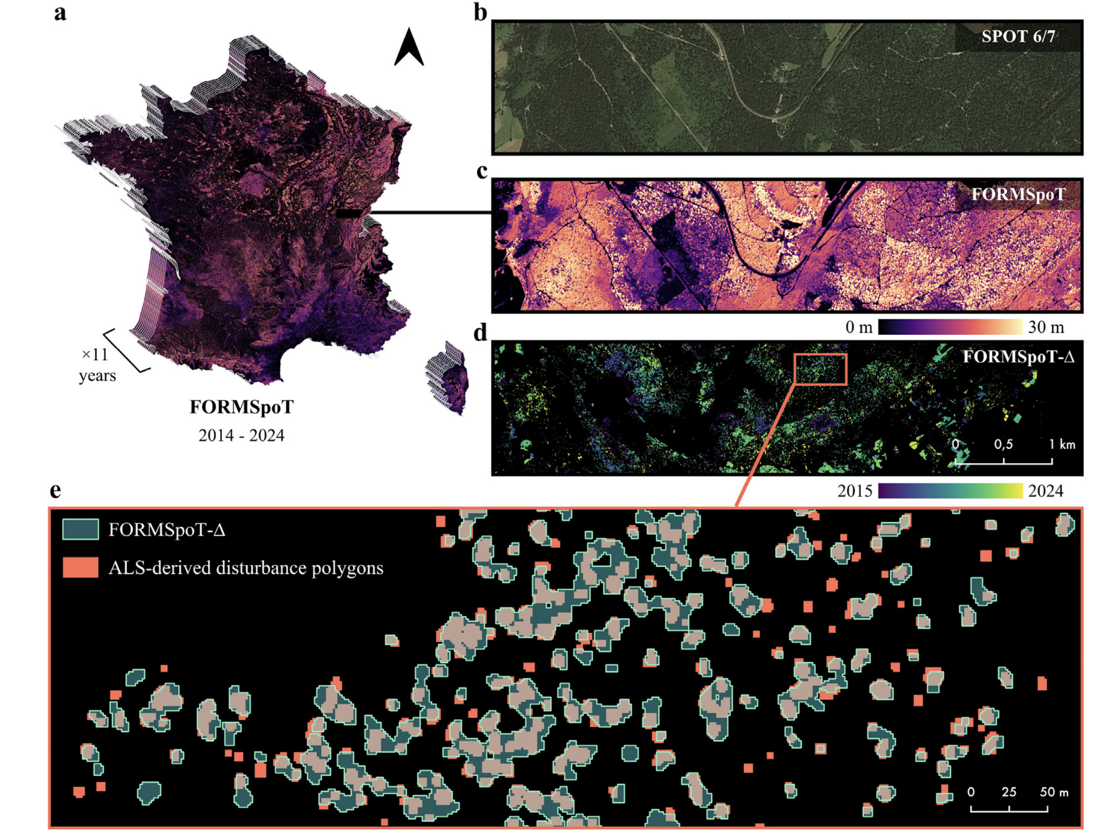
Today’s large-scale forest-monitoring systems work at 10 to 30 metres, too coarse to see individual trees, so they miss many small disturbances. My colleagues and I built FORMSpoT, a decade-long (2014 to 2024) map of French forest canopy height at 1.5 metre resolution from SPOT satellites, together with yearly maps of where trees were lost. This lets us detect forest disturbances tree by tree across a whole country.
-
 Integrating global canopy height models with satellite data for improved forest inventory in UkraineAgricultural and Forest Meteorology, Sep 2026
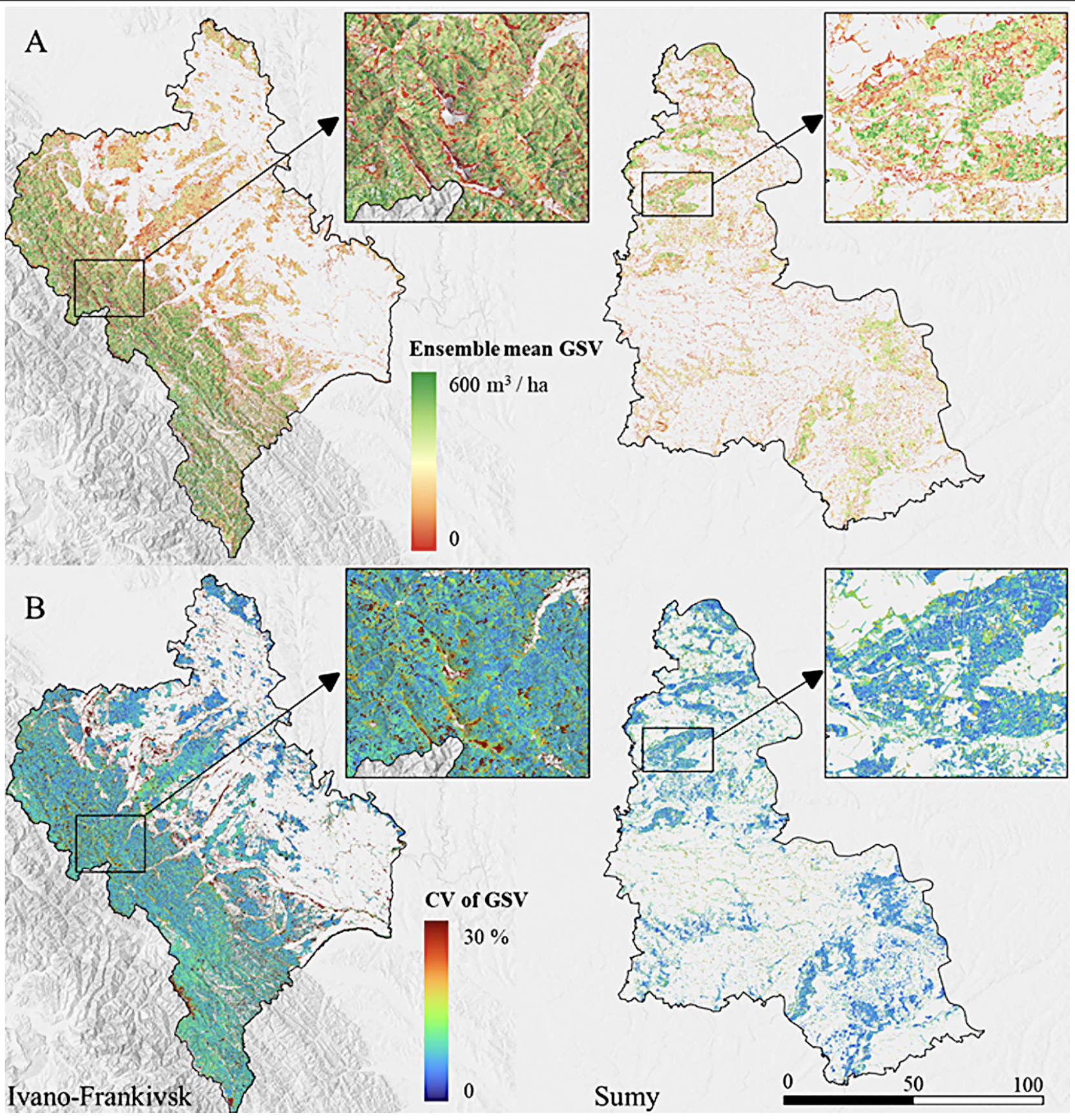
Ukraine’s forests cannot be surveyed on the ground during the war, so satellites are the only option. With Petr Lukeš and colleagues from CzechGlobe (Czech Republic), we combined global canopy-height models with multi-sensor satellite data to estimate forest structure in Ukraine with an accuracy close to airborne LiDAR. This offers a way to keep the national forest inventory running remotely.
-
 ProtoTree: An Efficient and Generalizable Model for Individual Tree Point Clouds AnalysisIEEE Transactions on Geoscience and Remote Sensing, Jul 2026
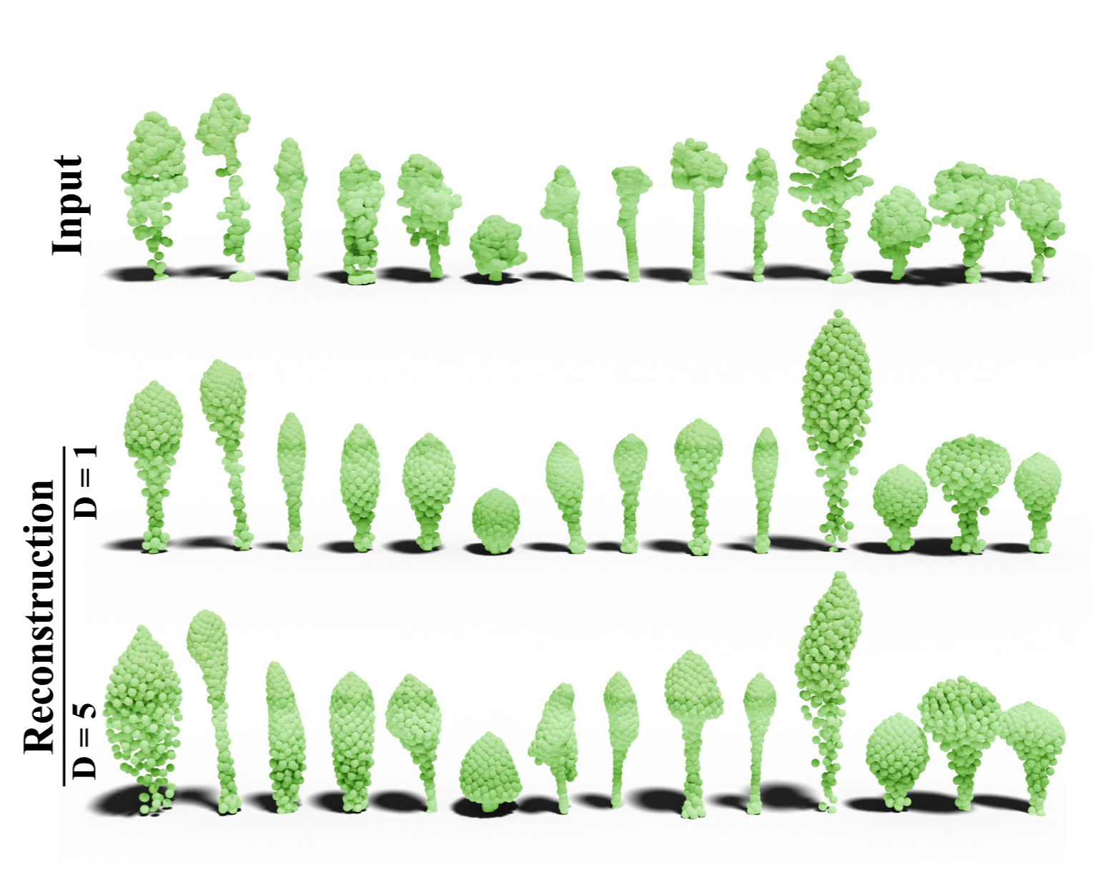
Measuring the volume, biomass and species of individual trees usually needs costly fieldwork or heavy 3D modelling. With Alvin Opler and colleagues, we developed PROTOTREE, an AI method that describes each tree by gently deforming a single learnable “template” shape, giving compact and interpretable descriptors that need very few labels to train.
-
 Alarming decline in the carbon sink of European forests driven by disturbancesNational Science Review, Jun 2026
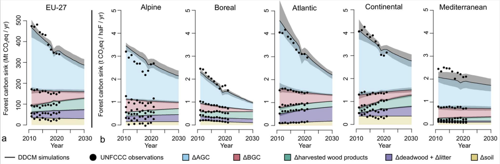
With Francois Ritter and colleagues from LSCE, we combined official country reports with satellite maps of forest loss and biomass to project the future of Europe’s forest carbon sink. Our model predicts a 39% drop in the EU carbon sink by 2030, driven by harvesting and natural disturbances.
-
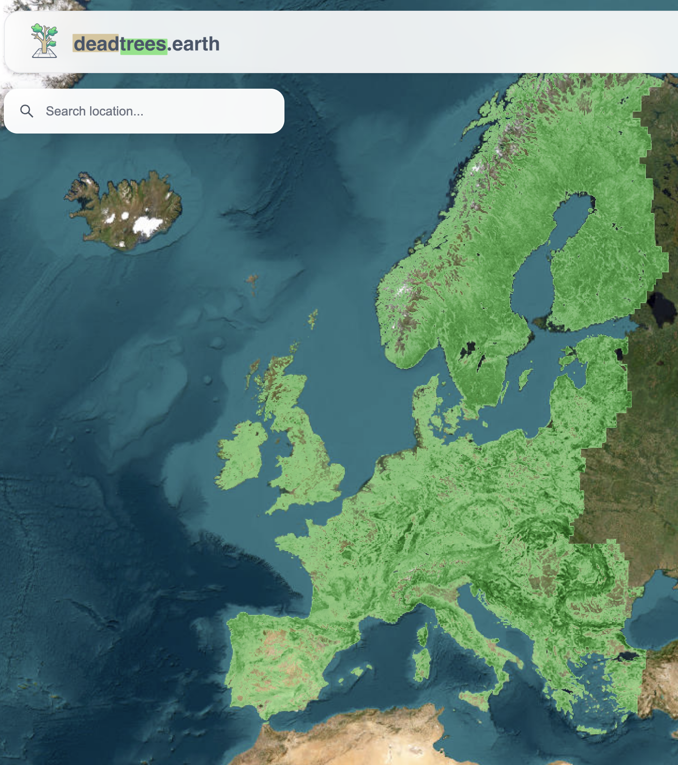 Sub-pixel mapping of disturbance and tree mortality dynamics from Sentinel-2 time series around the globePreprint, Feb 2026
Most satellite products can only flag whole pixels as “forest lost”, missing the early stages where just a few trees are dying. With Clemens Mosig and colleagues from the University of Leipzig, we developed a method to estimate, within each Sentinel-2 pixel, the fraction covered by dead or living tree crowns, revealing fine-scale forest decline around the globe.
-
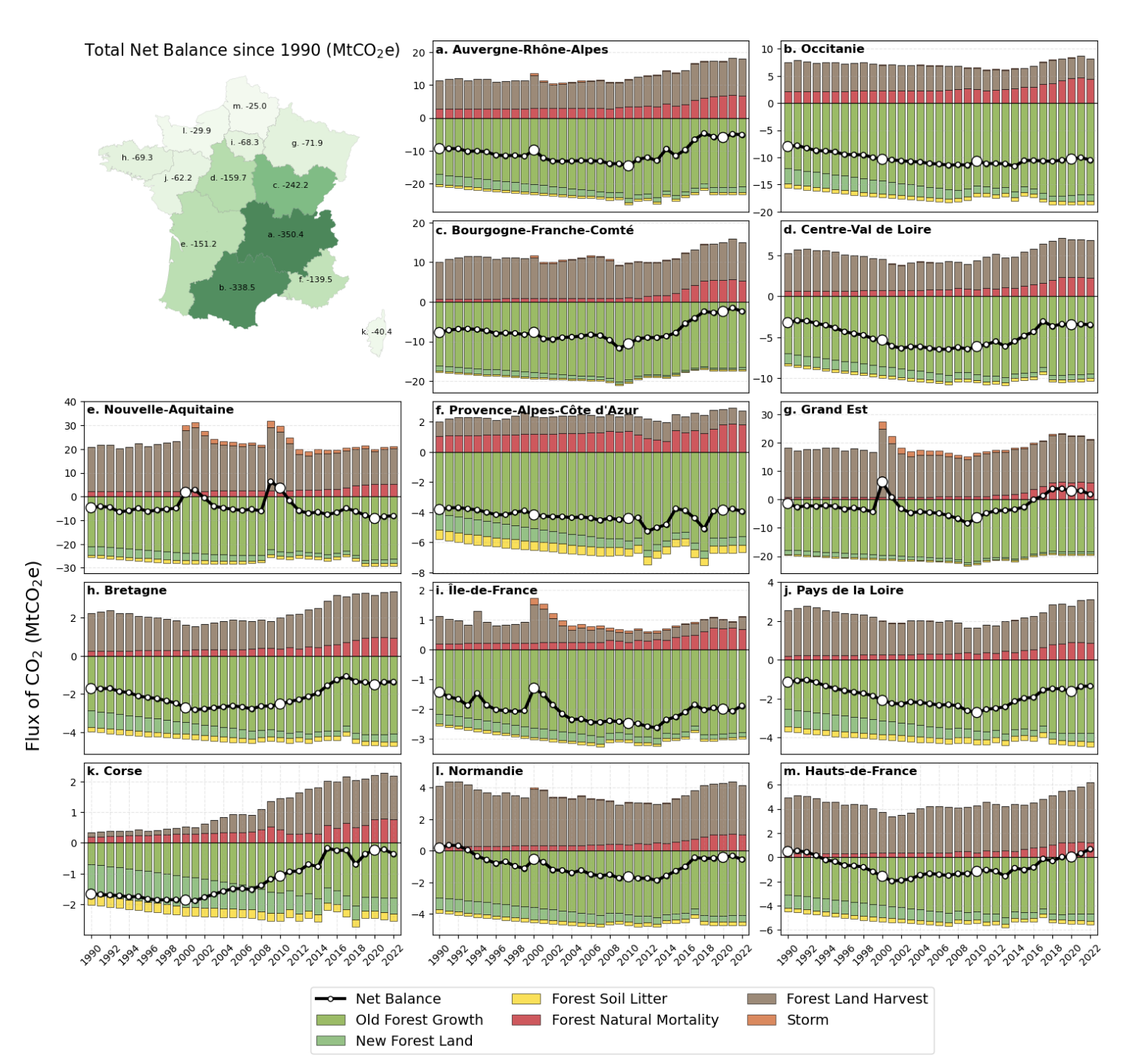 An outlook on the rapid decline of carbon sequestration and perspectives for an improved monitoring of French forestsComptes Rendus. Géoscience, Jan 2026
With Philippe Ciais and colleagues from LSCE, we tracked how the carbon stored in French forests changed from 1990 to 2022 using national inventory statistics, and showed that the forest carbon sink is declining. Because these statistics cannot pinpoint where carbon is lost to fires, droughts and insects, we set out how satellite remote sensing could fill that gap in the future.
-
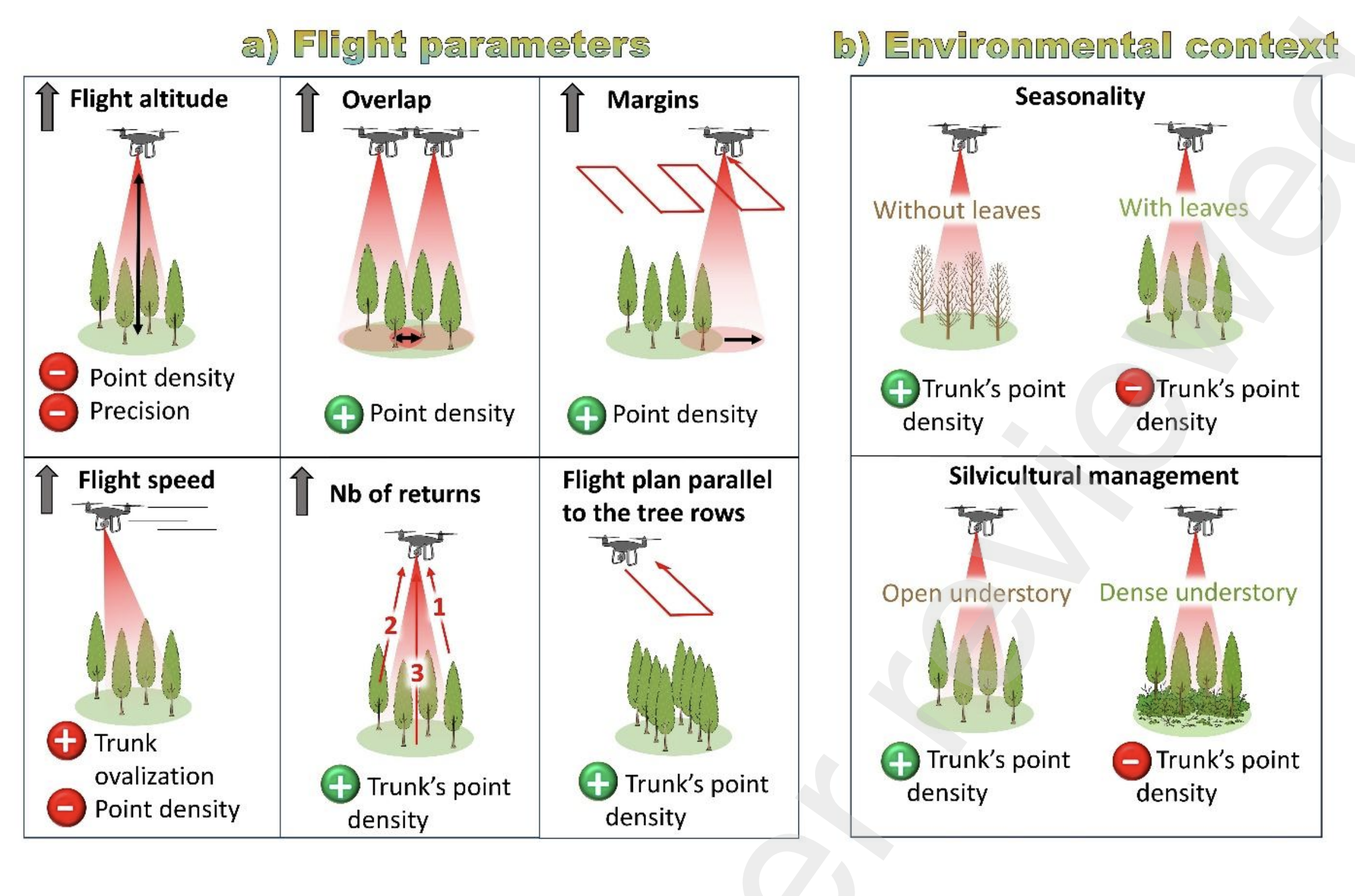 Impact of UAV Flight Parameters and Acquisition Context for Canopy Height and Trunk Circumference Measurement Using LiDARPreprint, Jan 2026
Drones carrying LiDAR can measure individual trees, but the results depend on how the drone is flown. With Clément Battista and colleagues from CESBIO in Toulouse, we systematically tested how flight altitude, speed and other settings affect measurements of tree height and trunk size in a poplar plantation in south-western France. The findings help set good practice for drone-based forest surveys.
-
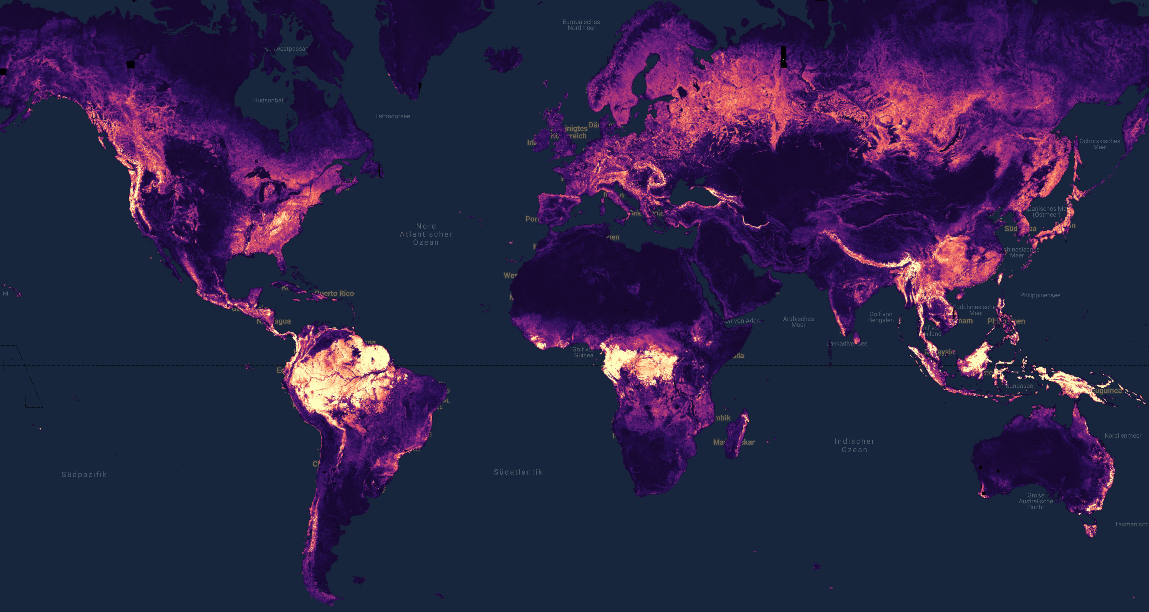 ECHOSAT: Estimating Canopy Height Over Space And TimePreprint, 2026
Global tree-height maps are usually single snapshots that cannot show change over time. With Jan Pauls and colleagues from the University of Münster, we introduced ECHOSAT, a global tree-height map at 10 metre resolution that stays consistent from year to year, using an AI model nudged to follow realistic tree growth. This makes it possible to track both growth and losses such as fires worldwide.
2025
-
 Retrieving yearly forest growth from satellite data: A deep learning based approachRemote Sensing of Environment, Dec 2025
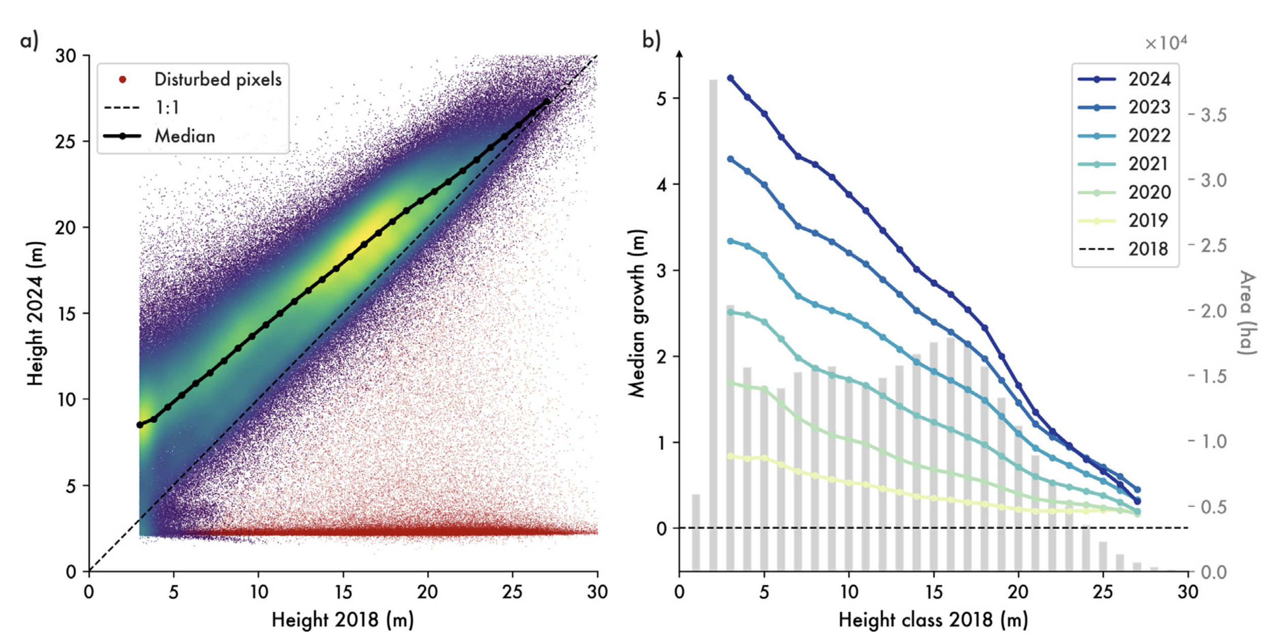
Existing satellite maps of forests are single snapshots, so they cannot show how a forest changes from one year to the next. My colleagues and I trained an AI model on Sentinel-1, Sentinel-2 and GEDI satellite data to produce yearly maps of the height, volume and biomass of France’s forests from 2018 to 2024, the first time forest growth has been tracked at the scale of individual stands from space alone. This opens the door to measuring how much carbon French forests absorb each year.
-
 SERA-H: Beyond Native Sentinel Spatial Limits for High-Resolution Canopy Height MappingPreprint, Dec 2025
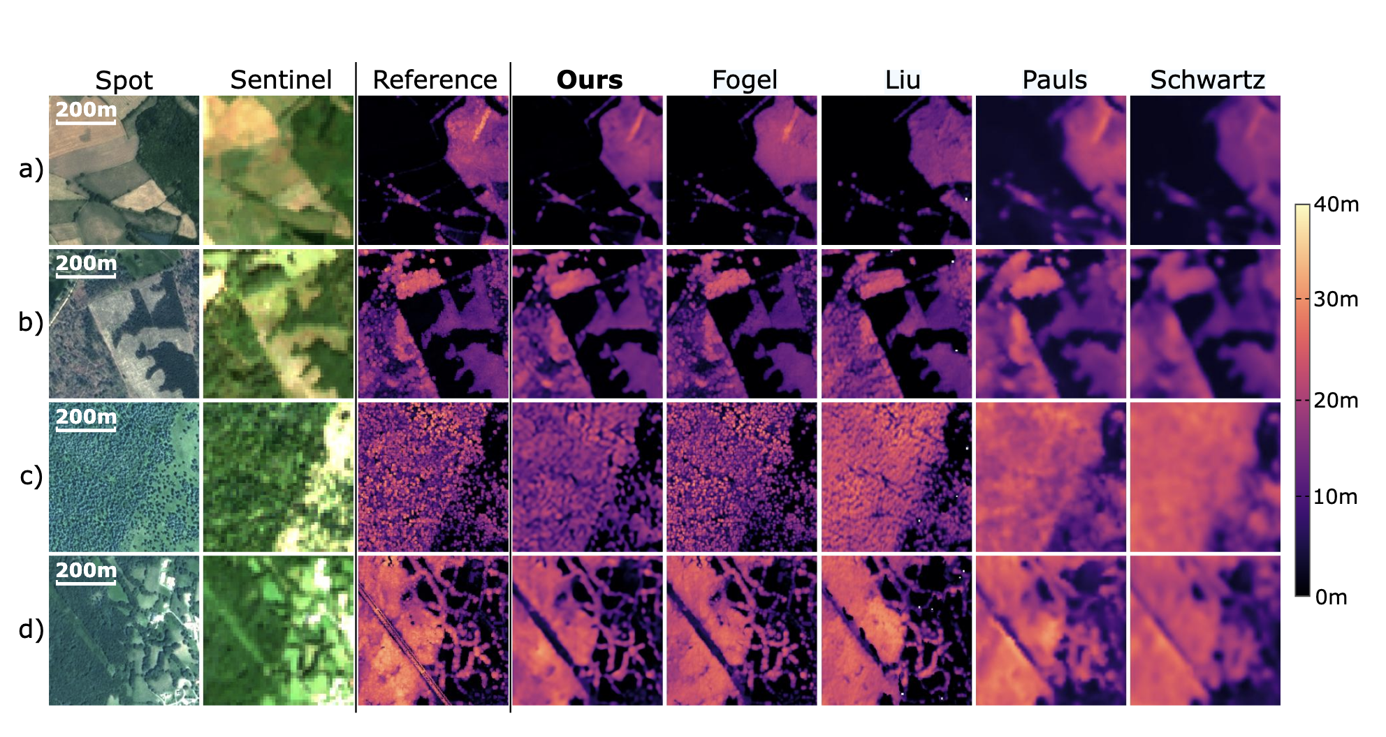
Freely available satellites such as Sentinel are limited to about 10 metre detail, which can blur individual trees. With Thomas Boudras and colleagues from LSCE, we built SERA-H, a model that combines image super-resolution with time-series data to map canopy height in finer detail than the raw satellite images allow.
-
 Satellite-based mapping of annual canopy height and aboveground biomass in African dense forestsFrontiers in Remote Sensing, Nov 2025
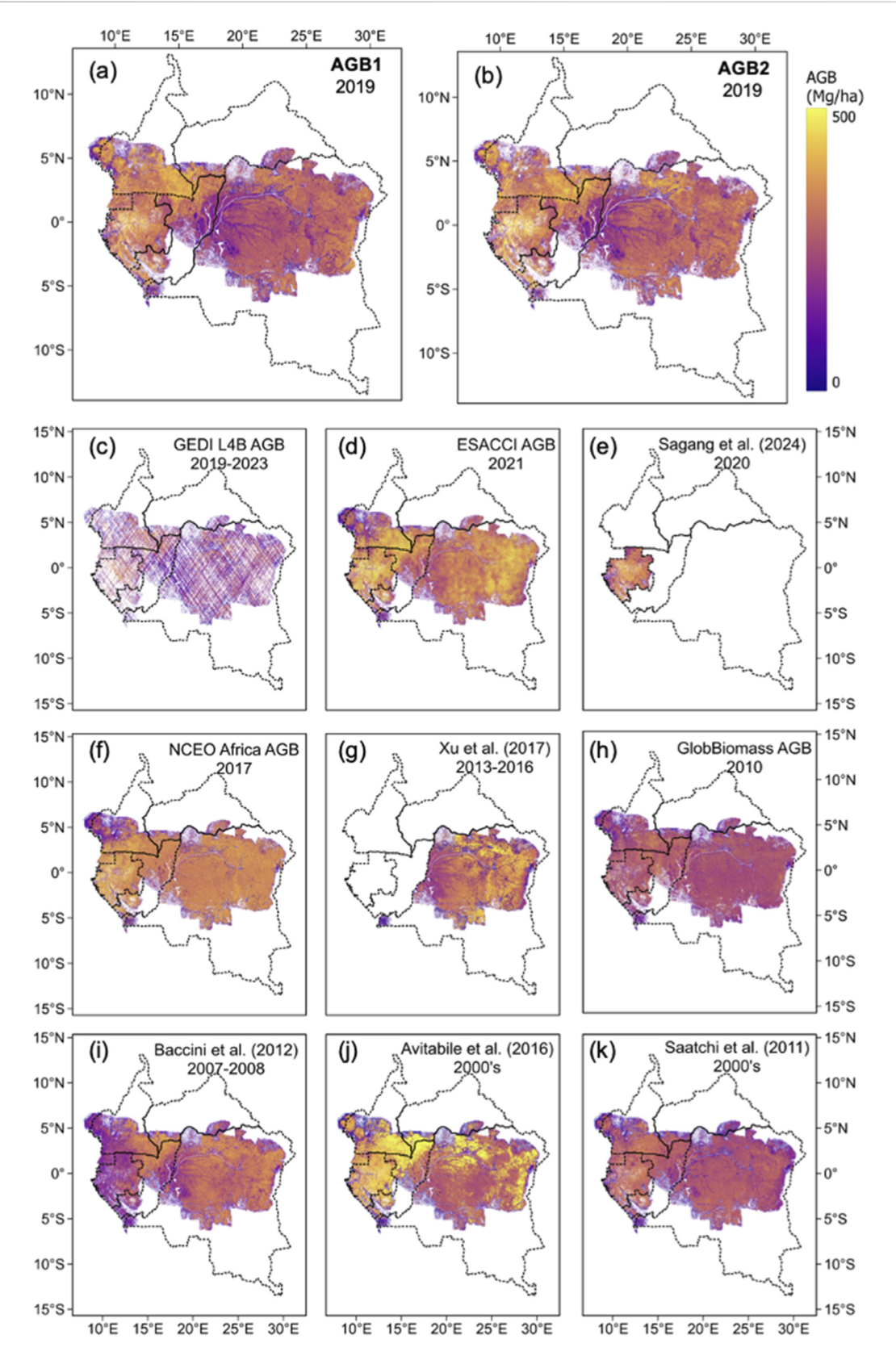
Mapping the tall, dense forests of tropical Africa from space is notoriously difficult because the satellite signals saturate. With Liang Wan and colleagues from LSCE, we trained a deep-learning model to produce the first annual maps (2019 to 2022) of canopy height and biomass for these forests at 10 metre resolution.
-
 GEDI and Sentinel data integration for quantifying agroforestry tree height and stocksJournal of Environmental Management, Oct 2025
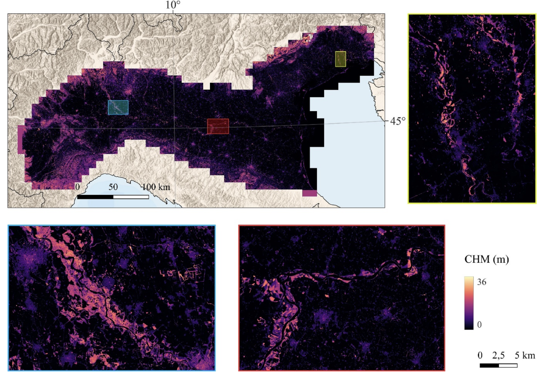
Poplar plantations scattered across farmland store carbon and supply timber, but they change fast and are hard to keep track of. With Giovanni D’Amico and colleagues from the University of Florence, we combined GEDI LiDAR and Sentinel satellite data to estimate the height and wood stocks of these agroforestry trees in Italy.
-
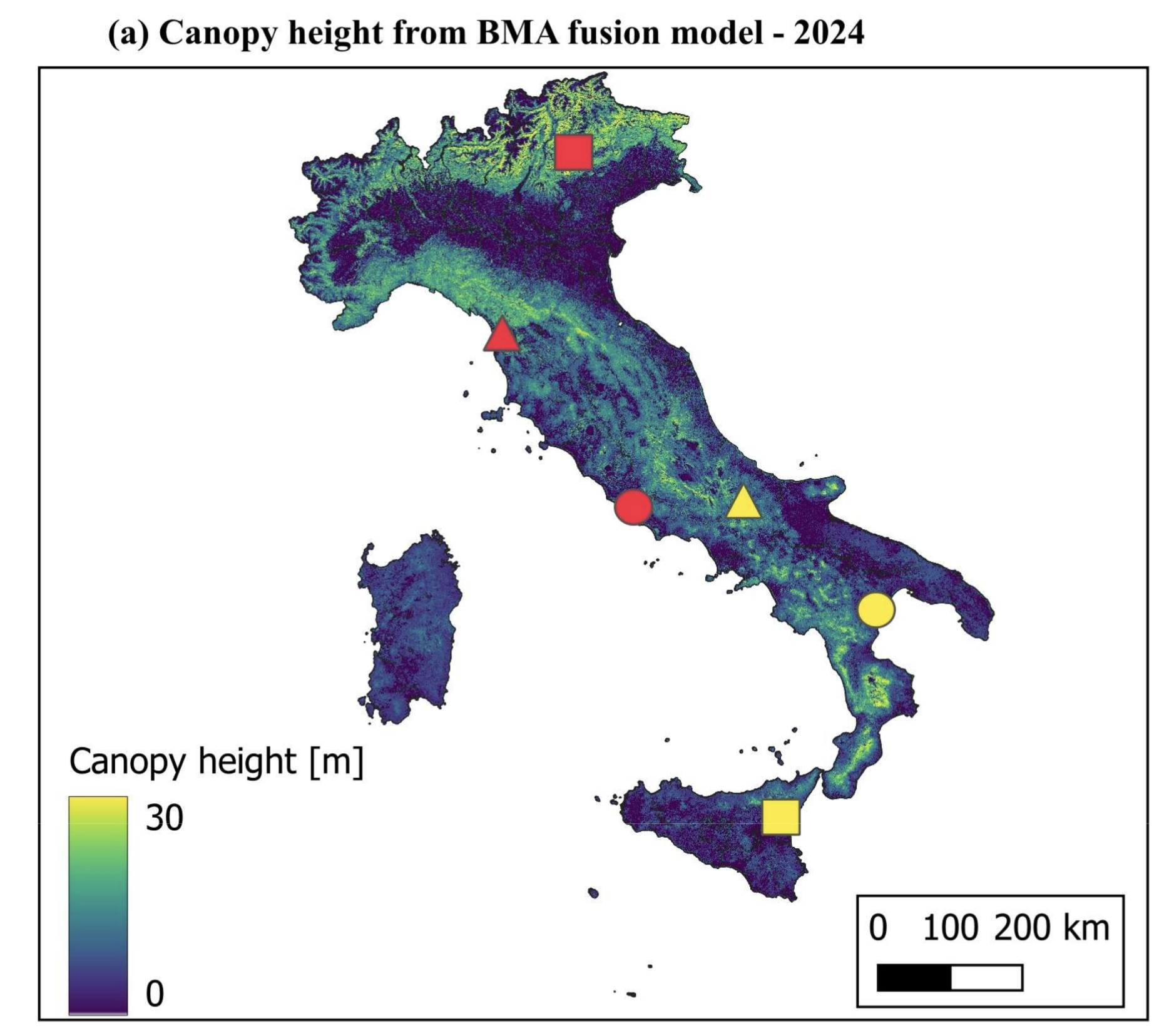 A fused canopy height map of Italy (2004–2024) from spaceborne and airborne LiDAR, and Landsat via deep learning and Bayesian averagingEarth System Science Data Discussions, Sep 2025
With Yang Su and colleagues from LSCE, we built a two-decade record (2004 to 2024) of forest canopy height across Italy at 30 metre resolution, blending Landsat satellite images with airborne and spaceborne LiDAR through deep learning and Bayesian averaging. Long time series like this show how forests have grown and changed over twenty years.
-
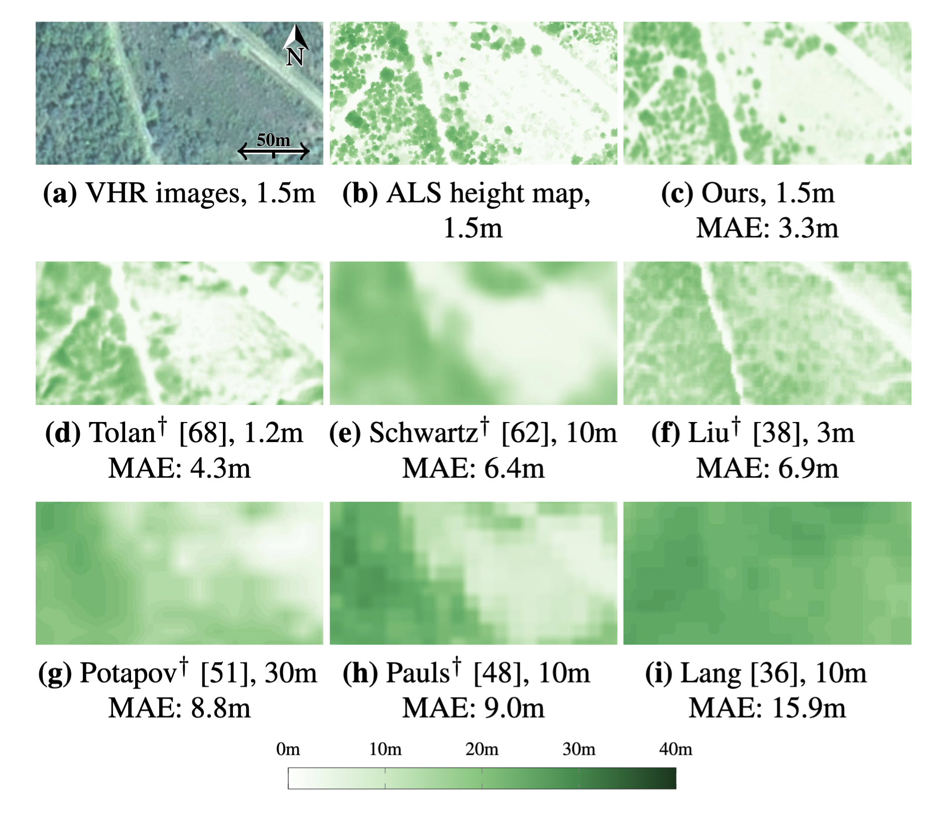 Open-canopy: Towards very high resolution forest monitoringProceedings of the IEEE/CVF conference on computer vision and pattern recognition (CVPR), Jun 2025
Progress in mapping forests from satellites is slowed by the lack of shared, high-quality datasets to test methods on. With Fajwel Fogel and colleagues from the École Normale Supérieure, we released Open-Canopy, the first open, country-scale benchmark for very-high-resolution (1.5 m) tree-height mapping, covering more than 87,000 km2 of France with satellite images and aerial LiDAR. It also includes a benchmark for spotting where individual trees have changed from one year to the next, so teams can train and fairly compare their models.
-
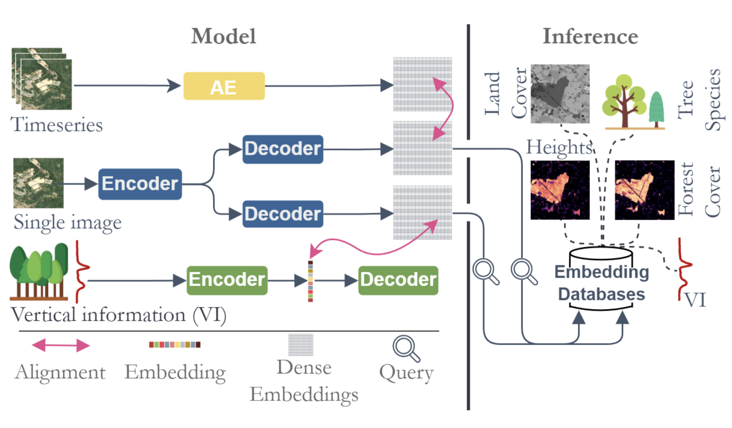 DUNIA: Pixel-Sized Embeddings via Cross-Modal Alignment for Earth Observation ApplicationsForty-second International Conference on Machine Learning (ICML), Jun 2025
With Ibrahim Fayad and colleagues from LSCE, we developed DUNIA, an AI method that learns a compact “fingerprint” for every pixel of a satellite image by aligning it with LiDAR data. Once learned, these fingerprints can tackle many environmental tasks, from mapping canopy height to classifying crops, often with very little extra training data.
-
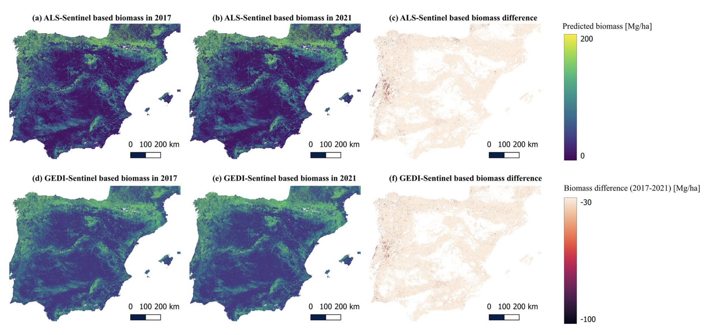 Canopy height and biomass distribution across the forests of Iberian PeninsulaScientific Data, Apr 2025
With Yang Su and colleagues from LSCE, we mapped the height and above-ground biomass of the forests of the Iberian Peninsula (Spain and Portugal) at high resolution, using Sentinel-1, Sentinel-2 and LiDAR data with deep learning. The resulting maps help track carbon stocks and support forest management across the region.
-
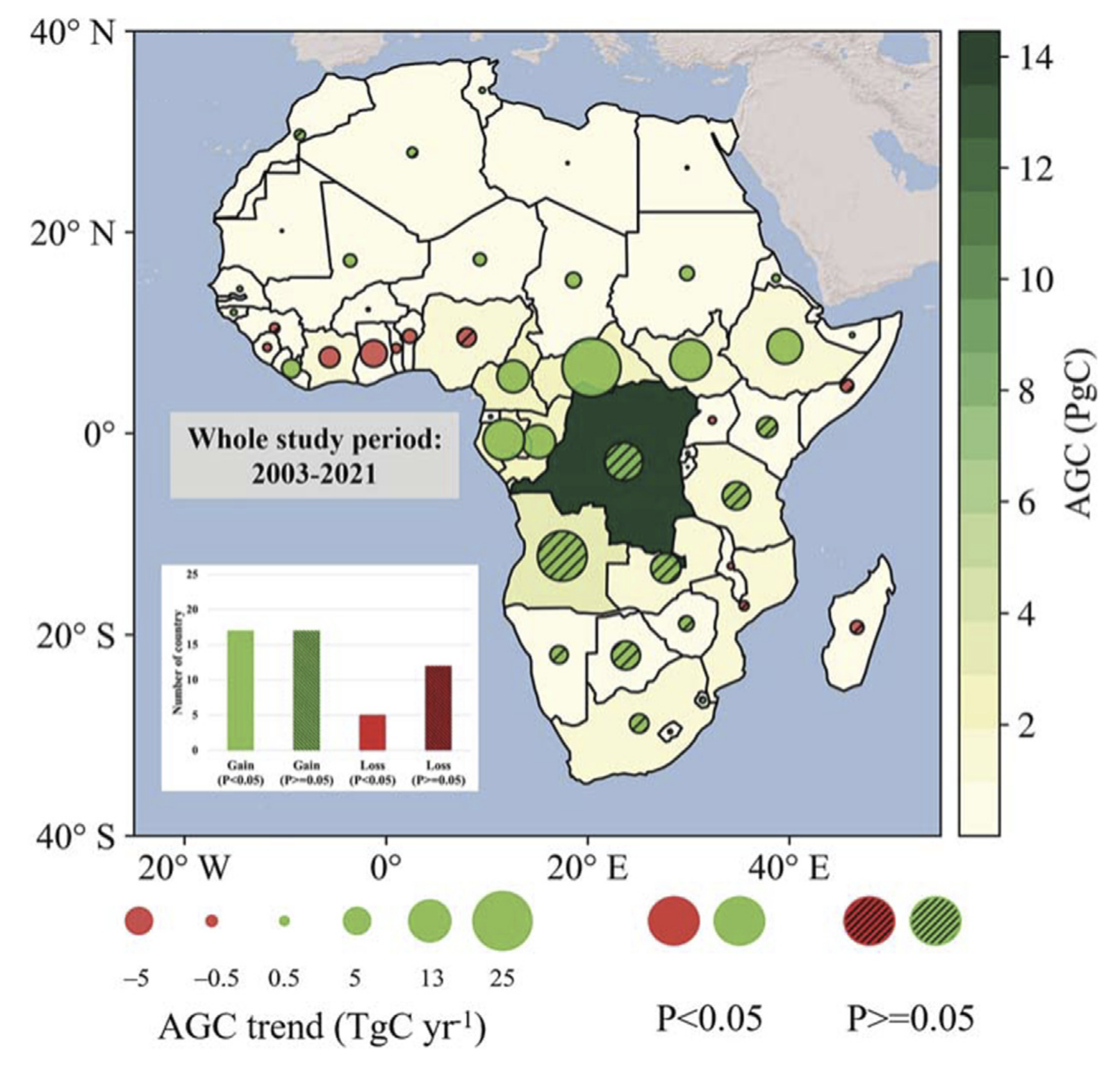 State of the art and perspectives for remote sensing monitoring of carbon dynamics in African tropical forestsFrontiers in Remote Sensing, Feb 2025
African tropical forests are vital for the climate but very hard to monitor. With Thomas Bossy and colleagues from LSCE, we reviewed how satellites (optical, radar and LiDAR) can track their structure, carbon and loss, and set out what is still missing.
-
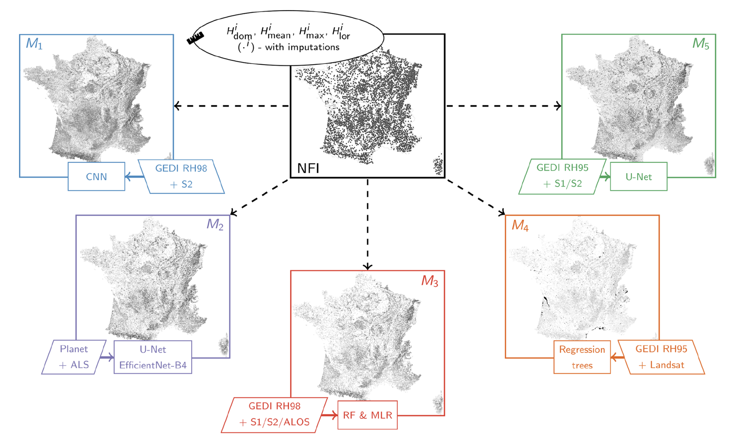 Remote-sensing-based forest canopy height mapping: some models are useful, but might they provide us with even more insights when combined?Geoscientific Model Development, Jan 2025
Many groups now publish their own satellite maps of forest height, and these maps often disagree. With Nikola Besic and colleagues from IGN, France’s national forest inventory, we showed that rather than picking one map you can combine several with a statistical method (Bayesian model averaging) to get a better estimate and, crucially, a measure of how uncertain it is.
2024
-
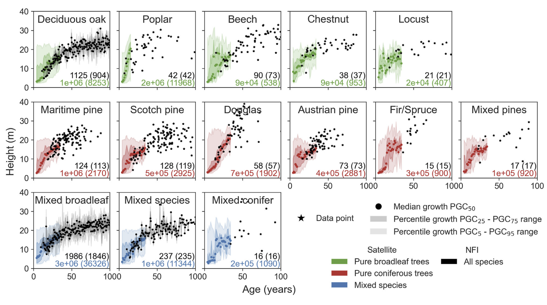 Combining satellite images with national forest inventory measurements for monitoring post-disturbance forest height growthFrontiers in Remote Sensing, Aug 2024
How fast a forest grows depends on the trees’ species and age and on their environment, but untangling these effects is hard. With Agnès Pellissier-Tanon and colleagues from LSCE, we combined field measurements with satellite data to build height-growth curves for French forest stands, and used machine learning to find which factors matter most. Age and species dominate, while the way a forest regenerates after disturbance, and local soil and climate, also leave a clear mark.
-
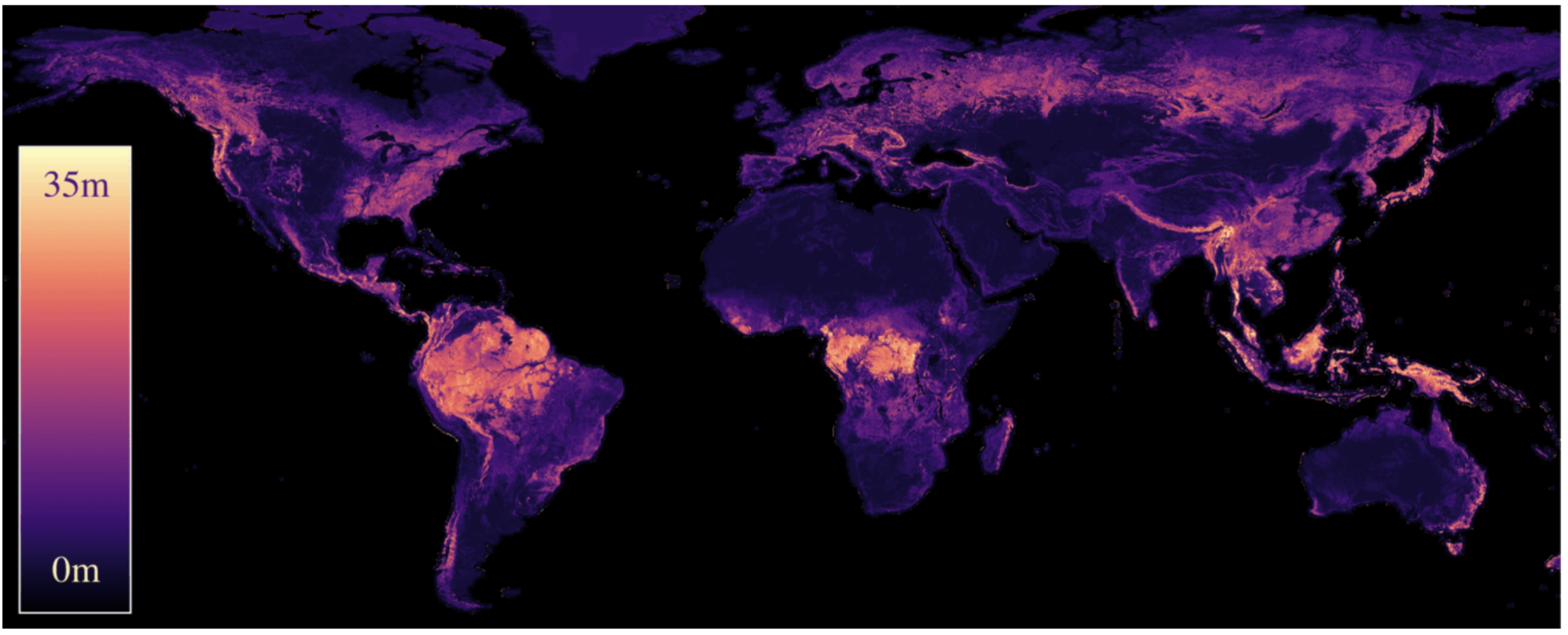 Estimating Canopy Height at ScaleForty-first International Conference on Machine Learning (ICML), Jun 2024
With Jan Pauls and colleagues from the University of Münster, we built an AI model that estimates the height of trees anywhere on Earth from satellite images. Our main ideas are a training method that copes with the small location errors in the reference measurements, and the use of terrain data to avoid mistakes in mountainous areas. The result is a global tree-height map that is noticeably more accurate than previous ones.
-
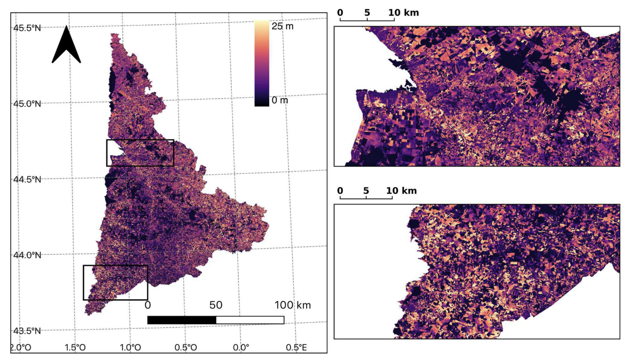 High-resolution canopy height map in the Landes forest (France) based on GEDI, Sentinel-1, and Sentinel-2 data with a deep learning approachInternational Journal of Applied Earth Observation and Geoinformation, Apr 2024
European forests are divided into small stands, so you need very detailed maps to tell them apart. Focusing on the Landes de Gascogne, France’s huge maritime pine plantation, my colleagues and I trained a deep-learning model on Sentinel-1 and Sentinel-2 images to map tree height at 10 metre resolution. This was an early proof that combining these satellites with AI can measure forest height accurately over a whole region.
-
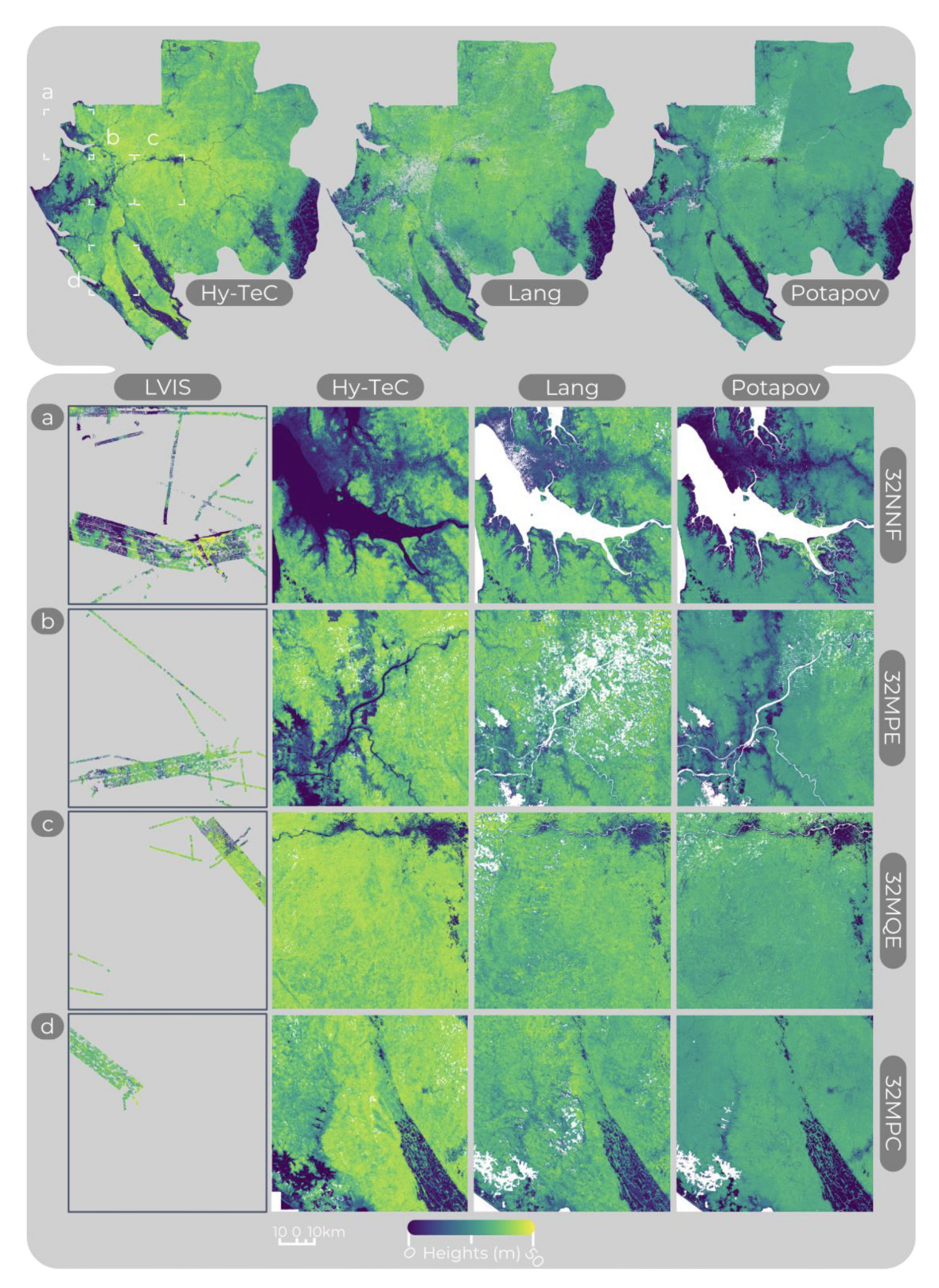 Hy-TeC: a hybrid vision transformer model for high-resolution and large-scale mapping of canopy heightRemote Sensing of Environment, Mar 2024
Knowing the height of trees across whole countries is key for tracking forest carbon, degradation and deforestation. With Ibrahim Fayad and colleagues from LSCE, we developed Hy-TeC, a deep-learning model that turns optical and radar satellite images into high-resolution, wall-to-wall maps of canopy height, trained against LiDAR height measurements.
2023
-
 Mapping forest height and biomass at high resolution in France with satellite remote sensing and deep learningPhD dissertation, Dec 2023
This is my PhD thesis, which ties together much of the work here. In it I developed methods that combine radar, optical and LiDAR satellite data with deep learning to map the height and biomass of French forests at high resolution, and applied them to questions such as forest growth and fire damage. It lays the groundwork for monitoring French forest carbon from space.
-
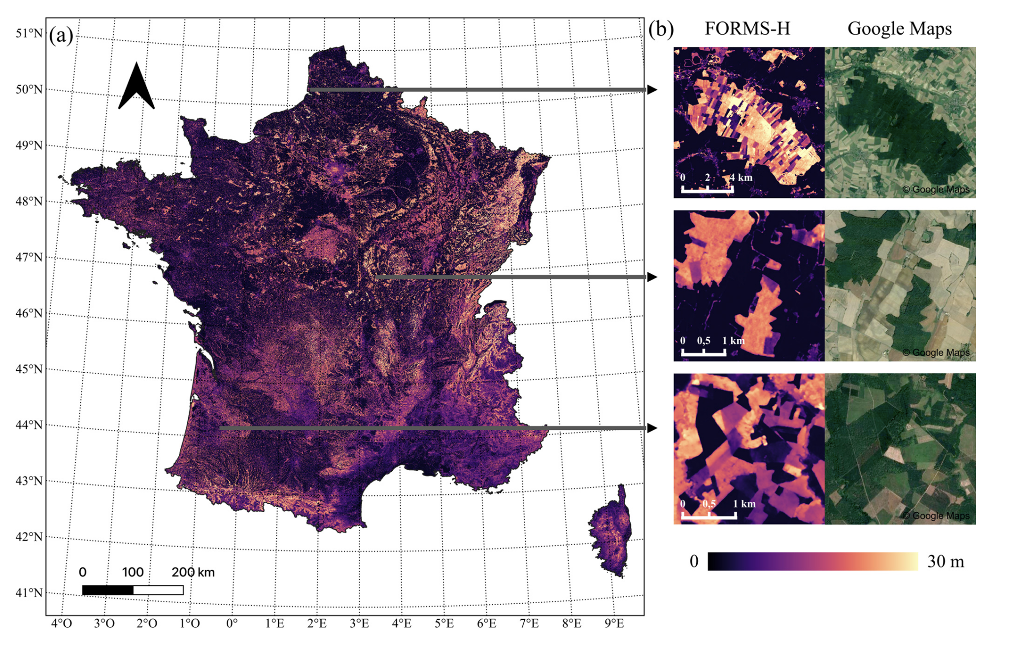 FORMS: Forest Multiple Source height, wood volume, and biomass maps in France at 10 to 30 m resolution based on Sentinel-1, Sentinel-2, and Global Ecosystem Dynamics Investigation (GEDI) data with a deep learning approachEarth System Science Data, Nov 2023
Forests store carbon, but France’s are split into many small, privately owned parcels that are hard to monitor. My colleagues and I used a deep-learning model fed with Sentinel-1, Sentinel-2 and GEDI satellite data to map the height, wood volume and biomass of French forests at 10 to 30 metre resolution. These maps, which we call FORMS, give a detailed nationwide picture to support forest management and carbon accounting.
-
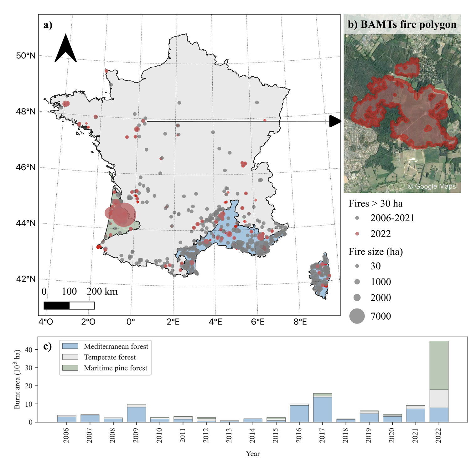 High-resolution data reveal a surge of biomass loss from temperate and Atlantic pine forests, contextualizing the 2022 fire season distinctiveness in FranceBiogeosciences, Sep 2023
France’s 2022 summer brought an exceptional fire season, with flames reaching temperate and Atlantic pine forests that rarely burn. Using high-resolution (10 m) satellite images, Lilian Vallet and I mapped where forests burned and how much woody biomass, and therefore carbon, was lost. We found the damage was far larger than usual outside the Mediterranean, a sign of how climate change is pushing fire into new regions.